As of 22 April 2009 this website is 'frozen' in time — see the current IFLA websites
This old website and all of its content will stay on as archive – http://archive.ifla.org
As of 22 April 2009 this website is 'frozen' in time — see the current IFLA websites
This old website and all of its content will stay on as archive – http://archive.ifla.org
Newsletter of the IFLA Section of Geography and Map Libraries (On-line)Newsletter 42
| ||||||||||||||||||||||||||||||||||||||||||||||||||||||||||||||||||
| Date | Admin | GEO-1 | GEO-2 | GEO-3 | GEO-4 | Bank balance | ||
| 20 Aug 97 | Balance | � | 100 | 1800 | 273.28 | 798.60 | 224.89 | 3196.77 |
| SEK | 1289.77 | 23190 | 3520 | 10290 | 2900 | 41189.77 | ||
| From HQ | +2451.68 | |||||||
| Interest | +3.93 | |||||||
| Expenses | -2923 | -5569.79 | 965.53 | |||||
| 15 Aug 98 | Balance | SEK | 822.38 | 17620.21 | 3520 | 9324.47 | 2900 | 34187.06 |
Figures are in Swedish Crowns except the first row.
Expenses were for the Copenhagen excursion and workshop and for the mailing of the World directory questionnaries.
In the evening Section officers (chairman, secretary, treasurer) attended the Officer's reception at the Amsterdam City Library including a boat trip on the canals.
On Sunday, August 16, we had been recommended to attend the Round Table on Audiovisual and Multimedia Workshop Looking for digital images, (reported at: http://archive.ifla.org/VII/rt5/annual/ann98.htm) with among others a paper by Patricia Alkhoven (Koninklijke Bibliotheek, The Hague): Atlases: images from Koninklijke Bibliotheek and the British Library. This was a project for the digitisation of two compiled atlases: Atlas Van der Hagen and Atlas Beudeker, and the result can be viewed by searching the Index of the Koninklijke Bibliotheek website: http://www.konbib.nl/home-fe.html.
On Sunday, there was also a Cataloguing Workshop providing the background for the recently published ISBD(ER), that is the International Standard Bibliographic Description for Electronic Resources. This is of great importance for the map community also, as demonstrated by one of the speakers, Sten Hedberg, who used cartographic examples.
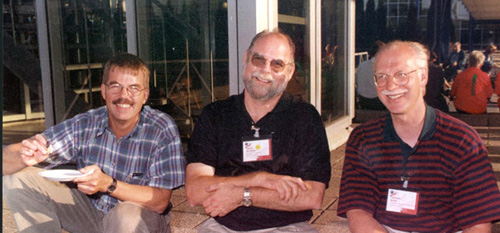
Happy company at one of the parties at the Congress Centre: Henrik Dupont, Royal Library, Copenhagen, Patrick McGlamery, University of Connecticut, Chris Baruth, American Geographical Society Collection, Milwaukee.
The papers were highly appreciated by the audience of about 15 listeners.
Before lunch we could also attend the Special Libraries Division Open Forum on the theme What's Special About Special Libraries?, with speakers from various American library associations: David Bender, Carla Funk and Roger Parent. Their papers were all published in INSPEL, 32(1998), No, 4, available at: http://archive.ifla.org/VII/s5/conf/sessamst.htm
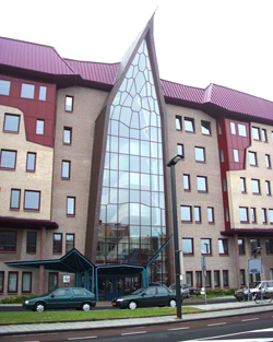
ITC entrance.
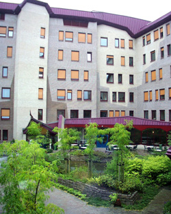
ITC interiour court with garden.
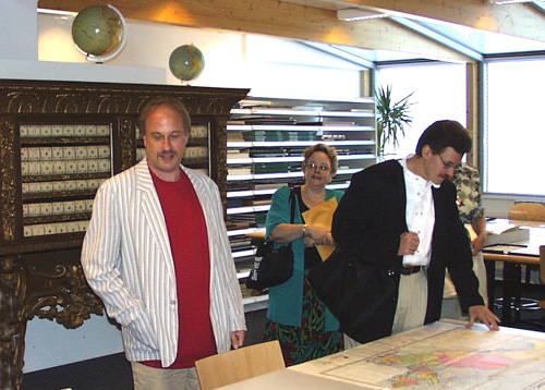
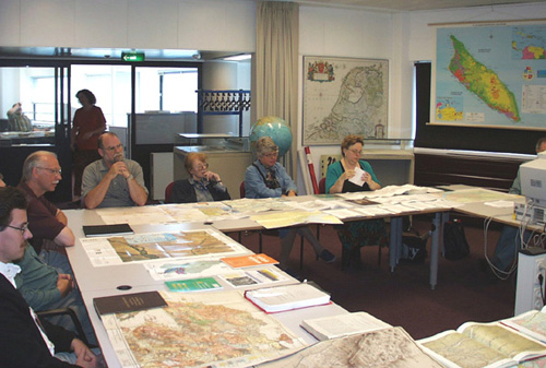
After coffee we had a tour through the ITC with its well-equipped GIS and cartographic laboratories including the library and map collection, where the librarian Marga Koelen demonstrated to us their classification system:

Demonstration in the Cartographic laboratory. Among others Jan Smits, David McQuillan, Natalia Kotelnikova, Henrik Dupont, Chris Baruth, William Lamble.
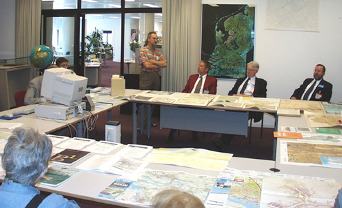
After lunch, we were given three presentations:
WWW: Offering and Finding Maps. - Menno-Jan Kraak (Chair, Dutch Cartographic Society, Professor at the ITC). He presented a model for the cartographic process, where spatial data, by a process of visualization (through the instrument of cartography or map design) is transformed into an image, i.e. a map. Much of Prof. Kraak's presentation can also be found in his paper Exploratory cartography - maps as tools for discovery, at the ITC website: http://www.itc.nl/kraak/
A Project Teaching Remote Sensing Classification Techniques: Monitoring Land Cover in Southern France. - Barend Köbben (Utrecht University and the ITC) (see: http://www.itc.nl/~kobben/).
Archiving Metadata: From Ideas to Implementation. - J.P.G. Bakx. (See Appendix.)
After tea, there was a demonstration of ILWIS, a GIS for land and water information.
Map displaying distribution of ITC students.
After this really instructive and generous visit there remained the two-hour train ride back to Amsterdam, and in the evening the Ministry of Culture Event at the Science and Naval Museums. At the latter, maps were indeed prominent. I found on display the four Vingboons 17th century manuscript maps covering the world, which were published by Leo Bagrow in 1948. They had been in Swedish private possession since the 17th century, but their location was unknown until they came out on the market and were bought by the Amsterdam Naval Museum at an auction in Stockholm.
Jan Werner lecturing in front of the Blaeu Atlas case. Audience: Alice Hudson and Olivier Loiseaux.
After this profoundly historical visit we took the train to The Hague, where Jan Smits, Map Curator at the Koninklijke Bibliotheek (The Royal Library) and the indefatigble organiser of our study program, demonstrated the Map Department, and held a presentation regarding the management of modern maps, cataloguing and metadata.
Jan Smits lecturing in the Royal Library Map Department...
... and his audience.
The Digital GeoData workshop, scheduled for Thursday, August 20, had unfortunately been cancelled because of too few registrations.
I had signed up for the Art Libraries workshop instead, which took place in the Rijksmuseum and happened to be also to a large extent on digital matters, i.e. digital image libraries.
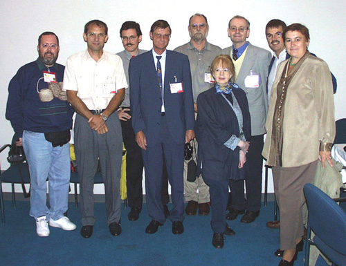
Standing Committee after second meeting. From the left: David McQuillan, Pierre Planques, Olivier Loiseaux, Helmuth Bergmann, Patrick McGlamery, Gudrun Zögner, Lothar Zögner, Henrik Dupont, Natalia Kotelnikova .
Then followed, for Section officers, the Special Libraries Coordinating Board II, with the summing up of the conference, financial advice, previews of the plans for the next conference, including themes as business intelligence and family history. There was a presentation of INSPEL, the International Journal of Special Libraries, now also on the Web: http://www-fh-potsdam.de/~IFLA/INSPEL/.
Later the same day, Patrick McGlamery and I visited the remarkable exhibition The Wonderful Alphabet in the New Church of Amsterdam, celebrating the 200th anniversary of the Koninklijke Bibliotheek. It consisted of 26 constructions inside the church, one for each letter of the alphabet presenting one aspect of the library. Under the letter B you found the Blaeu atlases, and also the digital presentation of the Atlas Van der Hagen and Atlas Beudeker, mentioned above, was on display. The exhibition can also be found by searching the Royal Library website: http://www.konbib.nl/home-fe.html.
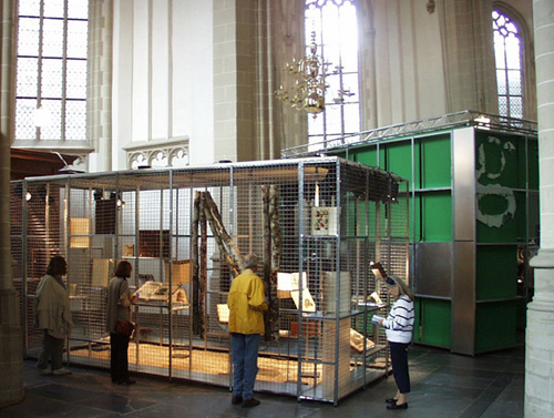
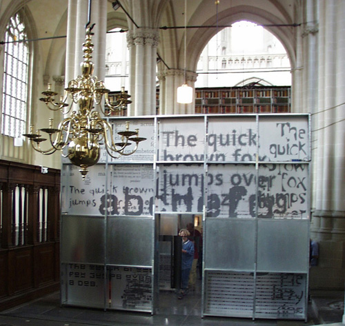
Two views of the Wonderful Alphabet exhibition in the New Church.
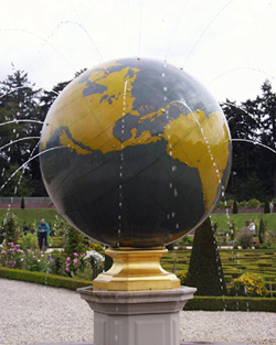
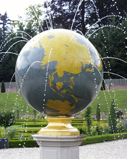
Two wievs of the Loo garden terrestrial globe fountain (with California as an island).
Due to its size, we have separated this document into 2 separate files.
42-06992.htm